
Sunlight filtered through the forest’s canopy and the sounds of the workaday world were nowhere to be heard. With sweat bleeding through my shirt, and 35 pounds of food and gear lashed to my back, I repetitively put one foot in front of the other and made my way into the wild. On this trip, labor and leisure would coexist without a hint of irony.
80 miles southwest of

The Pine Mountain Trail (PMT) is unique because it has something for everyone who loves walking through the outdoors, from novice backpackers to the highly experienced. It travels 23 miles up and down slopes, along ridgelines, and through the kinds of forested coves that are the
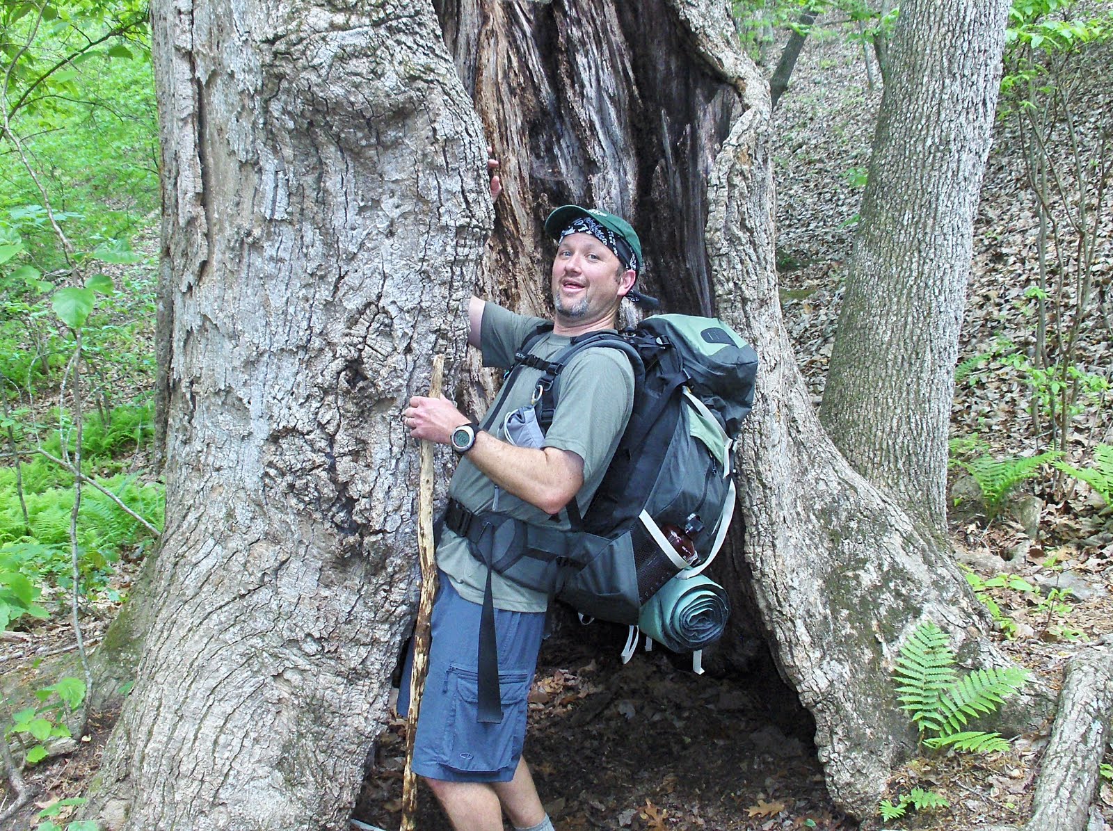
I walked the Pine Mountain Trail not long ago, with me in my late thirties and my hiking partners ranging from their early thirties to early forties. Although we had all engaged in many outdoor pursuits, none of us had backpacked before. We thought this trail network seemed like the perfect one on which to change that, and it proved us right. Below is a picture of me on day two of our trek, followed by one of Finney and Kevin on day one:

Much of the Pine Mountain Trail is serpentine, and instead of simply walking it from one end to the other, we chose to incorporate some of the connecting paths to create a route resembling a “reverse lollipop.” We started our journey near the Liberty Bell Pool, by stepping onto an unnamed access trail that ventures seven-tenths of a mile before hooking up with the PMT on the side of
Where the access trail ends, we turned to the right on the PMT and made our way to the Sawtooth Trail. We turned left on the Sawtooth and hiked 2.7 miles before meeting up again with the PMT. This saved about 2½ miles by avoiding the wide-arching, semi-circular route the PMT follows north of the Sawtooth. Along the way we stopped to drink from our water bottles at Grindstone Gap Campsite, where we saw a hummingbird and red-tailed hawk.
Back on the Pine Mountain Trail, we kept going until we reached Bethel Creek Campsite, where we cooked dinner on our foldaway stoves and set up camp for the night.

The next morning began with a two-mile hike up to the park’s highest point, Dowdell’s Knob, overlooking an expansive valley. When FDR used to convalesce in the town of


After taking in the view, we returned to the campsite, broke down our tents, and reloaded our packs. Then we filled our bottles with cold water from Bethel Creek and headed back in the direction from which we had come the day before.
But instead of turning back onto the Sawtooth Trail, we remained on the PMT and hiked that wide-arching, semi-circular route we avoided on day one -- and it proved to be the most topographically attractive part of our entire trip! The inclines on this section are more pronounced and the trail takes you up a particularly interesting rock formation. Much of this section is on north-facing slopes where the forest is moister than it is on the south-facing terrain of the Sawtooth.
After traveling more than 4½ miles from where we camped the previous night, we made it to Big Knot Campsite with hours of daylight remaining. Big Knot is perched on a wooded summit 1,000 feet above sea level, with stone rings set up to hold campfires and big logs set up to serve as benches. We pitched our tents, consulted our trail maps, and determined we were about a two-mile hike from the trailhead where our adventure had begun…then we decided we could hike to the car, drive to town for dinner, and make it back to camp before dark.
The first 1½ miles after leaving Big Knot made for one of the most demanding stretches of our entire trek. It took a little longer to reach the car than we expected, but once we did, we made it to the tiny town of

When our trip ended the next morning, we took this photo with a sign that we found lying in the brush near the trailhead:

The Pine Mountain Trail is an ideal destination for satisfying your desire to explore the wilderness. Before drinking any water you get from streams, just be sure you treat it to kill any disease-causing bacteria, either by boiling it or using various tablets or drops, my personal favorite being these.
You will need to reserve whichever campsites you use, so get a trail map ahead of time and plan your route. Be aware that you must check in at the state park office before hiking, and pay a parking fee of $5 per night for each car plus a backpacking permit fee of $9 per night for each hiker.
Lastly, if you have not backpacked before, make sure you are in decent shape before attempting it. You are responsible for bringing enough food to last the whole time (our side trip into town for dinner is not the kind of thing you can count on) and you must understand that despite backpacking’s minimalist air, there is a lot of equipment you will need to acquire. There is not enough space to delve into these issues in this post, but here is a good place to start reading about them.
I hope you make it to the PMT and enjoy it. Because it is located farther south and at lower altitudes than any of the East’s other major mountain paths, it allows you to experience the
In closing, here is a picture of mountain laurel along the PMT, followed by one of me and Kevin on the access trail:


Note: The picture at the beginning of this post, and the one of the laurel, are courtesy of Jim Hall of the Pine Mountain Trail Association. The “work detail” picture was taken by Finney, and the others with me in them were taken by Mike. The rest were taken by me.
Update, 4/4/11: As noted by Craig in the comments section below, the access trail (which I erroneously described as "unnamed") is actually part of the Pool Trail. In total, that path travels 1.8 miles to connect the Mountain Creek Trail to the PMT, and after 1.1 miles it crosses the road near the Liberty Bell Pool. It was at this road-crossing that my hiking partners and I started our trek.

What great pictures! It's fun living vicariously through your blog. I feel like a took a hike :)!
ReplyDeleteI note you've labeled this a 'beginner's trail' :). Is there such a thing as pre-beginners?
ReplyDeleteIt's a lovely trail, and I enjoyed sharing your trip. Since you also love San Francisco, I can see you have eclectic taste in tourism.
Sounds like a wonderful adventure. And, it sounds like you'll be hitting the trail again!! Enjoyed your photos. ~karen
ReplyDeleteToo cool! I came home to this link emailed to me by photographer Jim Hall (my brother). We had camped at Big Knot campsite just night before last.
ReplyDeleteSounds like you guys had a good time, I'm a PMTA lifetime member. The unnamed trail is called the Pool Trail, it connects the PMT to the Mountain Creek Loop Trail.
ReplyDeleteSometime in April I'm planning on a 1 day through hike and include the east end loop trail for a total of 26 miles.
Looks like a great trail...Nice tagging along!
ReplyDeleteThe Pine Mountain Trail looks like a good one for a first backpacking experience. Looks like a fun trip!
ReplyDeleteFriends of ours have walked all the App. trail except the last 150 miles, the less traveled section. They are finishing this year and are both in their 70's.
ReplyDeleteThe scenery is breathe-taking. Thanks for taking me along...I loved it.
BlessYourHeart
Loved the photos. Thanks for stopping on my blog...I hope you join(ed)on as a Follower...I just did to yours too.
ReplyDeleteKeep those great photos coming!
You haven't posted in awhile!! Looking forward to seeing what you've been up to! Hope everything's okay.~karen
ReplyDeleteWhat spectacular wilderness you hiked and camped in! Looks and sounds like a great place. If I ever get down south, I'll have to put this area on my list. Thanks for visiting my blog! -Heather of the Hills
ReplyDelete