Thursday, December 22, 2011

Winter Solstice


Here are some thoughts about the year’s coldest season on this, its first day:

I love how it begins with evergreen boughs on mantles, lighted trees in village squares, carols on the radio, and people knowing that life’s greatest joys come from giving rather than receiving.

I love its chilly mornings when fog clings to the surfaces of ponds.

I love sitting outside on those mornings drinking hot black coffee.

I love watching Sarah try to catch snowflakes on her tongue during our winter vacation.

I love driving across California’s High Sierra between snow drifts so deep they soar above cars and turn roadways into tunnels of white.

I love walking through Appalachian forests that are barren of leaves but laden with snow, and therefore have the appearance of black-and-white photos come to life.

And finally, I love that I can spend a whole day outside in Florida without feeling the need to shower every hour.

So for those who curse the cold: Remember that every season brings beauty, so long as we stop to notice it.

Sunday, December 4, 2011

In the strangest of places


Who would have ever thought that in order to see colorful waterfowl, dozens of varieties of marine life, and half-ton animals from the endangered species list -- all in the wild -- the best place to go would be right next to the building pictured above?

Actually, plenty of Floridians know that power plants create incidental wildlife sanctuaries during the winter months, but it’s a safe bet that very few tourists are aware of this. Therefore, millions of people who travel to the Sunshine State wind up missing sights that are not only interesting, but free.


The lynchpin in this whole phenomenon is the manatee: an aquatic mammal that bears a passing resemblance to the walrus and is a distant relative of the elephant. Manatees are about 10 feet long, weigh up to 1,300 pounds, and live in both the coastal and inland waters of Florida. Below is a pair that I photographed, but if you want to see a picture of one underwater, go here.


Manatees live in several areas of the earth, of which Florida is the furthest from the equator. That should clue you in that they are built only for warmth. When water temperatures dip below 68 degrees their digestive tracts start shutting down and their mortality rates start climbing, unless they are able to locate warmer water. That is where electric companies come into play.

To cool their generating units, power plants take water in from rivers and bays and then discharge it into canals, where it flows back to wherever it came from. Having gone through the plant, water in these canals is warmer than the water in its original source, and manatees have figured out that the canals are an ideal place to hang out when the Northern Hemisphere tips away from the sun.

TECO Energy’s Big Bend Power Station is located in Apollo Beach on the eastern shore of Tampa Bay, 16 miles from downtown Tampa. Back in 1986, TECO constructed a viewing platform at the eastern end of the discharge canal so people could observe the manatees:


In the quarter century since then, additions have been made and the platform has evolved into what is now called The Manatee Center. It includes a butterfly garden, environmental education building, and gift shop. It also includes a concession stand and picnic tables:


And it includes The Tidal Walk: a 900-foot walkway along the canal’s southern edge. Elevated for its entire route, the walk passes through a strip of mangrove forest then travels by unobstructed water and finally ends on a dock looking toward the openness of Tampa Bay.


Along the walk I have seen not only manatees, but sharks and dolphins as well. I have also seen fiddler crabs and yellow-crowned night herons, one of which is pictured in this post’s second photograph. Big fish ply the waters and pelicans seem to be everywhere:


As for the manatees themselves, they are numerous and a treat to observe. Erika, Sarah, and I have been here many times and their numbers have always been in the scores. It has been reported that more than 300 have been counted in the canal at a single time.

Unfortunately, the fact that manatees are in the water and you are not means it is difficult to get good pictures of them. Nevertheless, this shot of a calf nursing from its mother (the teat is near the flipper) is one I will always remember:


If you are going to be in the Tampa area during the winter, you should definitely put The Manatee Center on your list of places to visit. Pack a lunch and take a load off while you’re here by eating at one of the picnic tables. You will see things you are unlikely to encounter in most parts of the country, and unless you buy something from the gift shop or concession stand, you will not have to spend a penny!

Go here for driving directions.

Friday, October 21, 2011

Outdoor 76


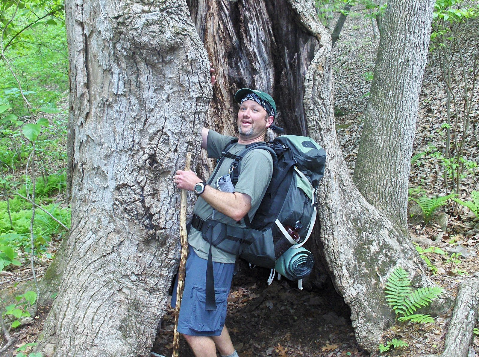
Many towns in the Southern Appalachians have one or two outfitter stores that are stocked with gear and staffed by people who can tell you about recreational opportunities in the area.

In my experience, every one of these stores is good -- but that does not mean they are all equal. Outdoor 76 opened one year ago in downtown Franklin, North Carolina, and if you are ever in the southwestern part of that state (or the northeastern part of Georgia) you should be certain to stop in.


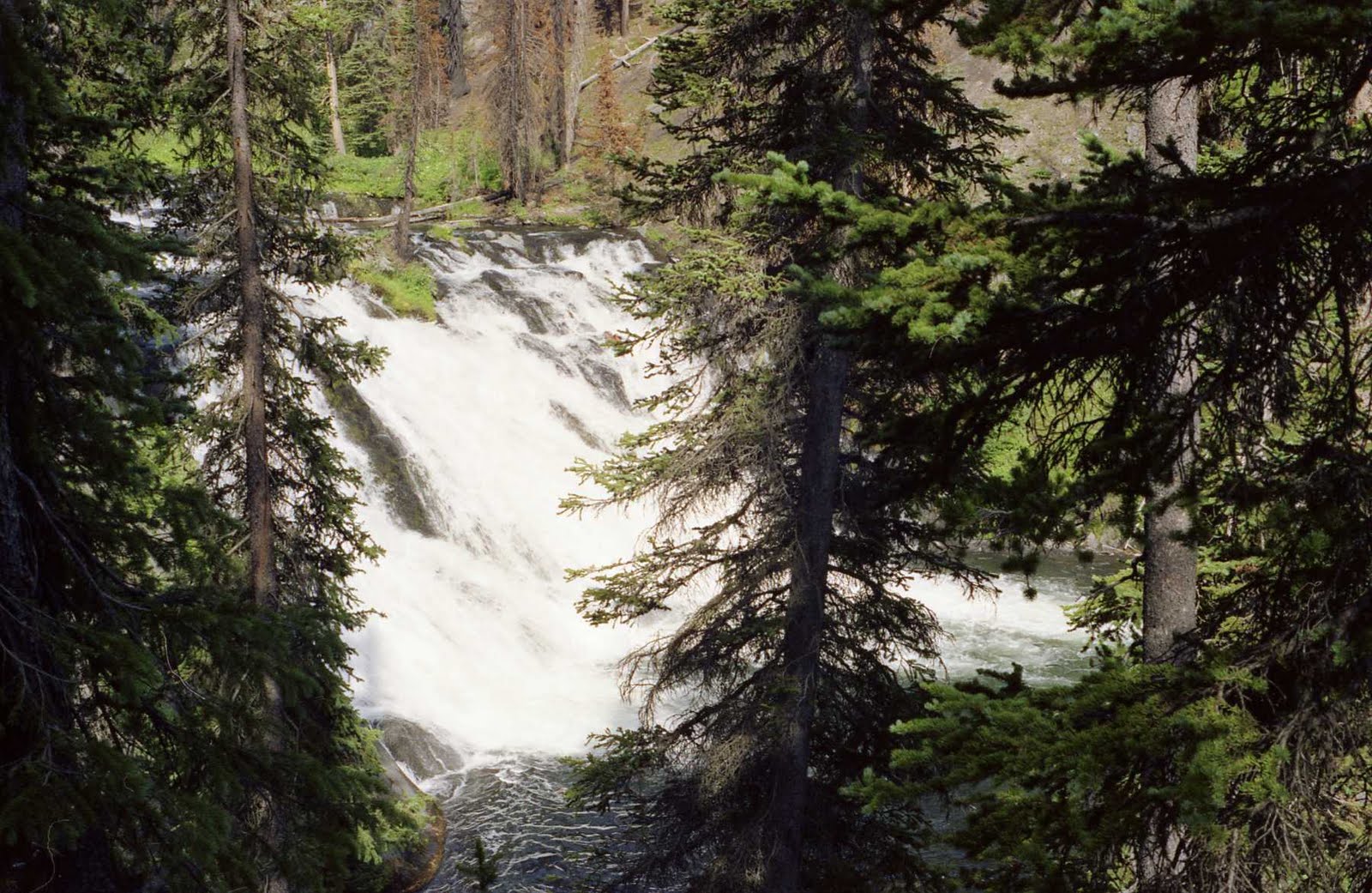
Franklin is surrounded by Nantahala National Forest and within 30 miles of both Great Smoky Mountains National Park and Chattahoochee National Forest. Miles upon miles of hiking trails, including the famous Appalachian Trail, can be accessed within a short drive of town; and in fact, Franklin is officially designated as an Appalachian Trail Community.

In addition to hiking, it is close to many places where you can engage in kayaking, whitewater rafting, rock climbing, laid-back “car camping,” and tubing (both on water and on snow), so you should have no doubt that it is a good place to visit if you like doing things outside.


Sure, when you are planning an outdoors exploit you can walk into your local Sports Authority, grab something off the shelf, perhaps cheaply, and be on your way. But if you want to select the right item, if you want to marry quality with price in making your decision, you won’t be likely to find any employees with the expertise to help you. Such is not the case at Outdoor 76, because its people have decades of combined experience venturing in the wild and using the items they sell.

The selection of high performance brands available here is impressive, with footwear from the likes of Keen and Salomon; clothing from Patagonia and Mountain Hardware; kayaks from Perception; backpacks from Marmot and Osprey; and backcountry stoves from Mountain Safety Research…and that sampling does not even begin to scratch the surface.


One thing that separates this merchant from the vast majority of outdoor retailers is that they not only sell gear, but rent it as well. If you have never been backpacking but want to give it a try -- but don’t want to shell out hundreds of dollars on a pack, hundreds more on a tent, and untold hundreds more on all the gear and accessories that are required before you even know if you will like the experience -- then this is absolutely the place for you. They will rent you gear at outstanding rates, make sure you have all the small but crucial items that are easy to overlook, and direct you to a trail route that is perfectly fitted to your experience and level of fitness.

Which leads me back to Outdoor 76’s greatest asset: Its people. The store’s web site says they will steer you right whether you are seeking only “a brief, quiet stroll” or “a multi-day expedition.” It says they “are committed to meeting your technical needs on the trail and your lifestyle off the trail,” and that they can help you “choose your adventure within almost any budget.” And when you visit the store you will quickly realize those words are true.


When some friends and I were there earlier this month, one of the owners, Rob Gasbarro, had dropped some customers off at the Appalachian Trail that morning. I mentioned to one of my friends that in lieu of our annual backpacking trip, next year we should consider making our first kayak camping trip. I then suggested that we make Fontana Lake the site of the trip, at which point Gasbarro pointed out that South Carolina’s Lake Jocassee might be a better option. He did that despite knowing that Fontana is not a bad option and that people going to Jocassee are heading to a location that makes them much less likely to patronize his store than if they are going to Fontana.

Outdoor 76 is the brainchild of Gasbarro and Cory McCall, and they are doing everything right for a new business. As you make your way toward downtown Franklin, you will see the store’s name on a few billboards -- enough of them that you notice, all done up in a way that piques your interest without any of the overkill that might turn you off. In a particularly good move for a new kid on the block, Outdoor 76 recently hosted one of the region’s largest outdoor festivals.

For these men to open a new business in a small town in today’s economic times, and to go about it so well, shows that the American spirit of daring, principled entrepreneurism remains alive. With their focus on all aspects of customer service, the people at Outdoor 76 make it easier to experience America’s beauty and wonder. If you pass within Franklin’s vicinity, do not cheat yourself by failing to take advantage of what they have to offer.

For more information, you may visit their web site, follow them on Facebook, or call them at 828-349-7676. And take note that they will soon be selling merchandise online.


Note: I became aware of Outdoor 76 because I used to work with Rob Gasbarro’s wife back before they escaped Florida and settled in “God’s country”…but I have traveled extensively in the Southern Appalachians and would not have written this post if I did not know it to be true based on my experiences.

Friday, September 23, 2011

Autumn Equinox


Some thoughts about autumn on this, its first day:

I love stepping outside on that first morning that fall’s nip is in the air.

I love how changing leaves turn Appalachian mountainsides into fiery palettes of orange, red, and gold.

I love driving winding roads through those mountains, catching glimpse after glimpse of falling leaves as they twirl their way to the ground.

I love cold nights marked by the scent of campfire and the sound of wind in the trees.

I love watching my daughter skip through the pumpkin patch looking for the perfect one to bring home.

I love walking behind her as she trick-or-treats on Halloween night.

I love pumpkin pie on Thanksgiving Day, and how it sets the ideal tone to start the Christmas season.

I love watching flocks of birds land in Florida at the end of their migration, while others keep flying to points further south.

And last but not least, I love football, especially college games where the fans are loud and the bands are blaring…and most of all, where Auburn is winning and the fight song you keep hearing begins with the line: “War Eagle, fly down the field, ever to conquer, never to yield!”

Thursday, September 1, 2011

New York Nexus

I have published this post before, but with the 10th anniverary of 9/11 upon us, I feel compelled to publish it again.


With September 11th upon us, it is only fitting to be thinking of New York. If you find yourself there, do not hesitate to do the usual tourist things. Go to the top of Rockefeller Center for a bird’s eye view of the city. Catch a Broadway show. Get your picture taken with the Statue of Liberty as a backdrop.

And of course, go to Ground Zero, stand on the sidewalk, look at the pavement on Church Street...and understand that it is the very pavement onto which people leapt hundreds of feet to their deaths on that horrendous morning in 2001.

But then it is time to depart from the usual tourist circuit by taking a short walk to my favorite New York City nexus. From Ground Zero you go one block east to Broadway, then two blocks south to Wall Street’s western terminus, directly across from Trinity Chapel:


Then, you walk through Trinity’s cemetery and take note of its eroded, centuries-old headstones. Make your way to the cemetery's southern edge and you will find the final resting place of a Founding Father, for there, marked by a modest obelisk, sits the grave of Alexander Hamilton. When we were there, somebody had laid a bouquet at its base:


Right beside Hamilton’s grave is that of Robert Fulton, father of the steam engine. Elsewhere in the cemetery is that of William Bradford, who came to the New World on the Mayflower and became the leader of Plymouth Colony.

Leaving Trinity, you cross Broadway and start down surprisingly nondescript Wall Street. Just one block onto it, with Trinity’s steeple looming behind you, you come to the site where George Washington took the oath of office as America’s first president:


And across the street from that site sits the New York Stock Exchange. We’ve all seen the images of frantic traders on the exchange floor, and we know the atmosphere inside must be noisy and stressful and chaotic. But the outside of the exchange building is a picture of serenity that is dwarfed by much of its surroundings. American flags flying beneath its facade of Corinthian columns give it the appearance of a county courthouse from somewhere in the heartland:


Here, within two city blocks, you will have walked in the footsteps of at least four major historical figures, including the father of our country; visited three of their burial sites; stood at the spot where our republic’s executive branch came into existence; and seen the building where more wealth has been created than at any other spot on the planet. And you will have done it in one of the busiest, most ethnically mixed cities in the world.

Here, you get a sense of the real New York, the one of consequence instead of glitz and glamor. Here, you understand why the city is really significant, and you can feel the pulse of human freedom running from the past to the future, coursing through you in the present. You will know you are alive, and I hope you know what I mean.

Monday, August 1, 2011

Serenity in Sonoma

Say the words “Glen Ellen,” and many Americans will think of those dependably low-priced wines that are sold from coast to coast:


There is obviously a winery with that name. However, Glen Ellen is actually a tiny country town (population 784) that is home to a number of remarkable wineries. Its street corners are spangled with signs pointing out which ones lie in which directions:


Located in California’s Sonoma Valley, Glen Ellen sits at the base of Sonoma Mountain and is considered part of the Sonoma Mountain American Viticultural Area. In plain English, that means it is part of a distinct area that is characterized by its geography and resulting microclimates, and is known to produce outstanding specimens of certain grape species.

The area around town is beautiful and its temperatures are pleasant. Oak forests grace much of the terrain, but there are redwood forests here as well, and the natural beauty inspired adventure writer Jack London to move here in the early twentieth century. Both the town and the valley are mentioned in several of his stories.

Beneath some redwoods he built a mansion that came to be known as Wolf House. Sadly, it was destroyed by fire the night before he and his wife were going to move into it, and he died three years later of kidney disease. Today, a visit to Jack London State Historic Park allows you to hike to the home’s ruins and to the moss-covered boulder under which the Londons are buried:


Glen Ellen’s most celebrated merchant, Benziger Family Winery, is located only a minute from the park and on the same road. Complete with handsome architecture and hillsides planted with vines, it is everything a winery should be. Visit the tasting room and you can try six of their selections for $10. Or you can take a tram tour of the property for $15. Or you can take a behind-the-scenes tour for $40. No matter what you do, you will get your money’s worth.


Valley of the Moon Winery, which borrows the name the Miwok Indians gave to Sonoma Valley, is less famous but offers an equally rewarding experience. Established in 1863, long before California became known for winemaking, it ranks as the longest-standing winery in the Glen Ellen area. Here is one of its vineyards that I photographed when we visited:


With harvest season coming up in September and October, now is the perfect time to plan a trip to this idyllic town. And if it is too late to make it this year, you might as well go ahead and make plans for 2012.

Go here if you want to stay in a creekside cottage or here if you want to rent a full house. Or if you prefer a more conventional inn, check out this place.

You do not have to be a wine lover to enjoy Glen Ellen. If you like walking around in the outdoors, there are opportunities to do so not only at Jack London State Historic Park but also at Quarryhill Botanical Garden. And if you are a foodie, you will be interested to know that Glen Ellen agriculture is renowned for olives as well as grapes. There are several high quality olive oil merchants here, including The Olive Press and B.R. Cohn (which is also known for its wine).

You will not regret visiting this simple and scenic spot on the map.


Note: The final picture was taken from B.R. Cohn’s Facebook page, and shows its Gourmet Shop where free olive oil and balsamic tastings are offered.

Friday, July 1, 2011

Walkin' in the Woods


It is obvious that I like to hike. Although hiking has been the topic in only two of my forty-six posts, it has been a topic in fifteen more.

Exactly one year ago I wrote about four walks to waterfalls in a particular area of North Carolina. In selecting them, my only criteria were “that they be easy enough for a family with kids to complete” and “that the drive from town to trailhead not take more than several minutes.”

Today I have decided to write another post about family-friendly hikes, but without confining myself to one area and without requiring that the trails be close to town. So here, in alphabetical order, are four of my favorite easy hikes in America -- and it is pure coincidence that once again, waterfalls are seen on all of them:


Abrams Falls Trail, Tennessee

At 2.2 miles one-way and 4.4 round-trip, this is the longest walk I will mention here, and if your kids are younger than seven or eight you might end up carrying them part of the way. The trailhead is located approximately five miles onto the Cades Cove Loop Road in Great Smoky Mountains National Park, and the trail parallels the course of Abrams Creek while following a series of modest undulations up to a low ridge. After attaining the ridge, it switches back and descends the other side to where the waterfall awaits.

Abrams Falls is only 20 feet tall, yet it carries an enormous amount of water that makes it more striking than some falls that are much taller. And that water plunges into a deep pool that is one of the best swimming holes in the mountains, so if you make this hike on a hot summer day, feel free to jump in and cool off. While you’re at it, keep an eye out for otters swimming in the stream and playing on the banks. Just be sure not to walk on the rocks, which are very slippery and have led to many injuries over the years.


Lewis Falls Trail, Wyoming

Ten miles after driving into Yellowstone National Park through its southern entrance, you will cross a bridge over the Lewis River, from which Lewis Falls is visible upstream. Turn off the road after crossing the bridge and you will find that the beginning of the wide, well-trodden path to the falls is obvious. This is another waterfall that impresses because of its sheer water volume rather than its height; and it is also impressive because of its 60-foot width and because some of the trees around it still show signs of the fires that raged through Yellowstone 23 summers ago. The walk is ridiculously short (less than a tenth of a mile) and provides a perfect example of how a simple change in perspective can make a big difference in the way an object appears: The first picture below was taken at the beginning of the walk, while the second was taken near its end.


Pfeiffer Falls and Valley View Trails, California

In California’s Coastal Range is Pfeiffer Big Sur State Park, where these two trails combine to form a 2½-mile loop. Start on the Pfeiffer Falls Trail (PFT) and do not take the left hand turn onto the Valley View Trail (VVT) that you see early on. The PFT ascends through a redwood forest while following the course of a gently cascading creek. After seven-tenths of a mile it ends at Pfeiffer Falls, from which you will backtrack a short distance and then take the right fork to the VVT, crossing a pair of bridges in short order.

Take the next right turn you come to and follow it to the VVT’s northern terminus where the trail offers up this view of the Big Sur Valley. From here, turn around and remain on the VVT until it ends by emptying onto the PFT back at that junction you skipped at the beginning. By the end of this hike’s 2½ miles you will have experienced an elevation change of 450 feet -- big enough to count, small enough for the whole family to complete.


Rainy Lake Trail, Washington

This trail is remarkable in that it takes you to a high-altitude alpine lake in one of the most rugged and remote corners of America, but is easy enough that it can be completed even by the wheelchair-bound. The one-mile haul to the lake departs from a high point on the south shoulder of the North Cascades Highway; remains almost perfectly level the whole way; and on top of that, is paved. Once you reach the lake you will see that it is a sight to behold, surrounded by snowy, chiseled ridges and fed by ribbon-like waterfalls flowing down the slopes on the opposite side. Fishing is allowed. The trail is within Ross Lake National Recreation Area, which bisects North Cascades National Park, and its trailside signs are very informative. If you want to see a better shot of the view I photographed below, go here.


Tuesday, June 21, 2011

Summer Solstice


Because I do not like hot weather, summer is my least favorite season. But there are still things I enjoy about it, and surprisingly, some of them are specific to this sweat-soaked state in which I live. So here are some thoughts on summer’s first day:

I love opening the season with our annual Beach Weekend.

I love Independence Day.

I love that there is one time of year when I am able to prefer chilled white wine over room temperature red wine.

I love when evening breezes carry the sweet scent of orange blossoms across Florida.

I love watching swallow-tailed kites, one of my favorite birds of prey, as they soar in the air and seem to stay up there forever without flapping their wings.

I love watching fireflies illuminate the woods at dusk.

I love San Diego.

I love the dramatic pulse of Florida’s afternoon storms, when black clouds darken the sky and spew lighting and thunder and unleash torrents of blinding rain – only to blow away and be replaced by sunny skies in less than an hour.

And I especially love that on the second day of this summer, we will get to meet our son.

Tuesday, June 14, 2011

Flag Day

For Flag Day, I figured it would be a neat idea to "illustrate" the lyrics to God Bless America using pictures I have taken throughout this great country -- so here goes:


God bless America...


Land that I love...


Stand beside her and guide her...


Through the night...


With the light from above...


From the mountains...


To the prairies...


To the oceans white with foam...


God bless America...


My home sweet home...


We are blessed to live here, so as much as you can in your life, be sure to travel through America and appreciate its every nook and cranny!


Note: The final picture was taken by Kelly Noel.

Sunday, May 29, 2011

Where Heroes Rest

The scent of eucalyptus filled the air as I stood on a bluff gazing out at the Golden Gate Bridge. Far below that, the water flowing from the Pacific Ocean into San Francisco Bay looked deceptively calm as it passed between the craggy headlands of two peninsulas, and I thought about the fact that this spot was called “the Golden Gate” long before anyone considered building a bridge across it.

But the inconspicuous view behind me was every bit as inspiring as that grand view in front of me. I kept glimpsing back at a military cemetery that was stretched out on a verdant hillside, complete with long rows of those unmistakable, Tylenol-tablet headstones. Although parts of the cemetery were visible, the elevation and eucalyptus trees lent a degree of separation from the throngs of camera-toters photographing the bridge.

That was the day I decided that no matter where you are in the United States, a visit to a military cemetery is never a bad idea. And today is the perfect time to share that thought, as we enter a five-week stretch that includes four patriotic holidays and anniversaries: Memorial Day on May 30, followed by the anniversary of D-Day on June 6, Flag Day on June 14, and Independence Day on July 4.


Military cemeteries are places of solemn contemplation. The people laid to rest in them are true heroes, not fictional ones from comic books. They placed their lives on the line -- and in many cases lost their lives -- to protect the freedom we take for granted.

These cemeteries are also places of beauty and symmetry, from their uniform rows of headstones to their stately rows of mausoleums.


And they are places of tranquility, infused with a kind of stillness that words can not describe. When I recently visited Florida National Cemetery, where my grandfather was buried in 2008, I was met with a sense of peace that was overpowering. Maybe that is because these places also have a sense of purpose, borne from the understanding that the people buried in them lived lives of service and were secure in the knowledge that they made a positive difference during their time on Earth.


Military cemeteries (or national cemeteries, as some are properly called) can be found all across America, so you do not need to be somewhere like Arlington to visit one. For a list of their locations, go here or here. Pay a visit to one in the coming weeks and I guarantee you will not regret it.

And with Memorial Day being tomorrow, if you are in the mood to contemplate its meaning while sitting at your computer, allow me to humbly refer you to my past scribblings here and here.


Note: All of the pictures on this post were taken at Florida National Cemetery, which is a splendid place to see. However, it ranks as one of my all-time biggest “travel regrets” that I neglected to take any pictures of the cemetery by the Golden Gate.

Friday, April 1, 2011

A Mountain Meander


Sunlight filtered through the forest’s canopy and the sounds of the workaday world were nowhere to be heard. With sweat bleeding through my shirt, and 35 pounds of food and gear lashed to my back, I repetitively put one foot in front of the other and made my way into the wild. On this trip, labor and leisure would coexist without a hint of irony.

80 miles southwest of Atlanta, a series of long ridges rises to mark the beginning of the Appalachian Mountains. Extending through Georgia’s FDR State Park, these ridges are home to a well-maintained hiking trail that is one of America’s best-kept secrets.


The Pine Mountain Trail (PMT) is unique because it has something for everyone who loves walking through the outdoors, from novice backpackers to the highly experienced. It travels 23 miles up and down slopes, along ridgelines, and through the kinds of forested coves that are the Appalachians’ calling card. The terrain it travels is vertical but not daunting, with a top elevation of only 1,395 feet. Backcountry campsites are spread out every few miles, and the PMT connects with 20 miles of other paths that can be used as shortcuts or to create long loops.

I walked the Pine Mountain Trail not long ago, with me in my late thirties and my hiking partners ranging from their early thirties to early forties. Although we had all engaged in many outdoor pursuits, none of us had backpacked before. We thought this trail network seemed like the perfect one on which to change that, and it proved us right. Below is a picture of me on day two of our trek, followed by one of Finney and Kevin on day one:


Much of the Pine Mountain Trail is serpentine, and instead of simply walking it from one end to the other, we chose to incorporate some of the connecting paths to create a route resembling a “reverse lollipop.” We started our journey near the Liberty Bell Pool, by stepping onto an unnamed access trail that ventures seven-tenths of a mile before hooking up with the PMT on the side of Indian Mountain.

Where the access trail ends, we turned to the right on the PMT and made our way to the Sawtooth Trail. We turned left on the Sawtooth and hiked 2.7 miles before meeting up again with the PMT. This saved about 2½ miles by avoiding the wide-arching, semi-circular route the PMT follows north of the Sawtooth. Along the way we stopped to drink from our water bottles at Grindstone Gap Campsite, where we saw a hummingbird and red-tailed hawk.

Back on the Pine Mountain Trail, we kept going until we reached Bethel Creek Campsite, where we cooked dinner on our foldaway stoves and set up camp for the night.


The next morning began with a two-mile hike up to the park’s highest point, Dowdell’s Knob, overlooking an expansive valley. When FDR used to convalesce in the town of Warm Springs, one of his favorite pastimes was to be driven to Dowdell’s Knob so he could enjoy the view while eating. Today his grill remains fixed on the edge of the knob, and some distance from it a statue of him surveys the scene.


After taking in the view, we returned to the campsite, broke down our tents, and reloaded our packs. Then we filled our bottles with cold water from Bethel Creek and headed back in the direction from which we had come the day before.

But instead of turning back onto the Sawtooth Trail, we remained on the PMT and hiked that wide-arching, semi-circular route we avoided on day one -- and it proved to be the most topographically attractive part of our entire trip! The inclines on this section are more pronounced and the trail takes you up a particularly interesting rock formation. Much of this section is on north-facing slopes where the forest is moister than it is on the south-facing terrain of the Sawtooth.

After traveling more than 4½ miles from where we camped the previous night, we made it to Big Knot Campsite with hours of daylight remaining. Big Knot is perched on a wooded summit 1,000 feet above sea level, with stone rings set up to hold campfires and big logs set up to serve as benches. We pitched our tents, consulted our trail maps, and determined we were about a two-mile hike from the trailhead where our adventure had begun…then we decided we could hike to the car, drive to town for dinner, and make it back to camp before dark.

The first 1½ miles after leaving Big Knot made for one of the most demanding stretches of our entire trek. It took a little longer to reach the car than we expected, but once we did, we made it to the tiny town of Pine Mountain within minutes. After buying Gatorade at a convenience store and guzzling it faster than you could imagine, we ate at a small restaurant called the Aspen Mountain Grill. The burgers were big and juicy and ridiculously inexpensive, and we worked them off by walking back to camp at an unhurried pace, arriving just before dark enveloped the woods.


When our trip ended the next morning, we took this photo with a sign that we found lying in the brush near the trailhead:


The Pine Mountain Trail is an ideal destination for satisfying your desire to explore the wilderness. Before drinking any water you get from streams, just be sure you treat it to kill any disease-causing bacteria, either by boiling it or using various tablets or drops, my personal favorite being these.

You will need to reserve whichever campsites you use, so get a trail map ahead of time and plan your route. Be aware that you must check in at the state park office before hiking, and pay a parking fee of $5 per night for each car plus a backpacking permit fee of $9 per night for each hiker.

Lastly, if you have not backpacked before, make sure you are in decent shape before attempting it. You are responsible for bringing enough food to last the whole time (our side trip into town for dinner is not the kind of thing you can count on) and you must understand that despite backpacking’s minimalist air, there is a lot of equipment you will need to acquire. There is not enough space to delve into these issues in this post, but here is a good place to start reading about them.

I hope you make it to the PMT and enjoy it. Because it is located farther south and at lower altitudes than any of the East’s other major mountain paths, it allows you to experience the Appalachians’ famous wildflower displays earlier in the year (and their famous fall foliage displays later in the year) than you can anywhere else.

In closing, here is a picture of mountain laurel along the PMT, followed by one of me and Kevin on the access trail:


Note: The picture at the beginning of this post, and the one of the laurel, are courtesy of Jim Hall of the Pine Mountain Trail Association. The “work detail” picture was taken by Finney, and the others with me in them were taken by Mike. The rest were taken by me.

Update, 4/4/11: As noted by Craig in the comments section below, the access trail (which I erroneously described as "unnamed") is actually part of the Pool Trail. In total, that path travels 1.8 miles to connect the Mountain Creek Trail to the PMT, and after 1.1 miles it crosses the road near the Liberty Bell Pool. It was at this road-crossing that my hiking partners and I started our trek.